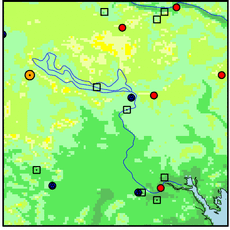
DANFORTH
| Name: | DANFORTH |
Lattitude: | 45.67 |
|---|
| Station ID: | 171833 |
Longitude: | -67.88 |
|---|
| Data Type: | Air Temperature (C) |
Elevation: | 115.8 (m) |
|---|
| Data Source: | NCDC |
Beginning Year: | 1978 |
|---|
| State / Province: | ME |
Ending Year: | Present |
|---|
| Other Close Sites |
|---|
| Data Type | PointID |
Name |
|---|
| Precipitation (mm) |
171833 |
DANFORTH |
| Snowfall (mm) |
171833 |
DANFORTH |

Station Data File:
| Point Id | Year | Air Temperature C |
|---|
| Jan |
Feb |
Mar |
Apr |
May |
Jun |
Jul |
Aug |
Sep |
Oct |
Nov |
Dec |
| 171833 |
1970 |
|
|
|
|
|
|
|
|
|
|
|
|
| 171833 |
1971 |
|
|
|
|
|
|
|
|
|
|
|
|
| 171833 |
1972 |
|
|
|
|
|
|
|
|
|
|
|
|
| 171833 |
1973 |
|
|
|
|
|
|
|
|
|
|
|
|
| 171833 |
1974 |
|
|
|
|
|
|
|
|
|
|
|
|
| 171833 |
1975 |
|
|
|
|
|
|
|
|
|
|
|
|
| 171833 |
1976 |
|
|
|
|
|
|
|
|
|
|
|
|
| 171833 |
1977 |
|
|
|
|
|
|
|
|
|
|
|
|
| 171833 |
1978 |
|
|
|
|
|
|
|
|
9.6 |
5.9 |
-0.4 |
-6.3 |
| 171833 |
1979 | -6.7 |
|
|
|
|
|
|
|
|
|
|
|
| 171833 |
1980 |
|
|
|
|
|
|
|
|
|
|
|
|
| 171833 |
1981 |
|
|
|
|
|
|
|
|
|
|
|
|
| 171833 |
1982 |
|
|
|
|
|
|
|
|
|
|
|
|
| 171833 |
1983 |
|
|
|
|
|
|
|
|
|
|
|
|
| 171833 |
1984 |
|
|
|
|
|
|
|
|
|
|
|
|
| 171833 |
1985 |
|
|
|
|
|
|
|
|
|
|
|
|
| 171833 |
1986 |
|
|
|
|
|
|
|
|
|
|
|
|
| 171833 |
1987 |
|
|
|
|
|
|
|
|
|
|
|
|
| 171833 |
1988 |
|
|
|
|
|
|
|
|
|
4.8 |
1.5 |
-6.9 |
| 171833 |
1989 | -7.1 |
-7.4 |
-4.2 |
1.5 |
12.0 |
15.1 |
16.8 |
16.5 |
12.0 |
6.0 |
-0.6 |
-8.9 |
| 171833 |
1990 | -5.7 |
-7.0 |
-2.7 |
3.9 |
9.3 |
16.1 |
18.4 |
19.4 |
12.8 |
8.3 |
1.2 |
-3.9 |
| 171833 |
1991 | -8.5 |
-5.6 |
-1.6 |
4.2 |
11.6 |
16.2 |
18.3 |
18.5 |
11.4 |
7.5 |
1.2 |
-7.5 |
| 171833 |
1992 | -8.0 |
-7.5 |
-4.9 |
2.3 |
10.3 |
15.7 |
15.9 |
17.4 |
13.3 |
5.2 |
-1.1 |
-5.3 |
| 171833 |
1993 | -7.6 |
-8.7 |
-3.7 |
3.8 |
9.7 |
14.4 |
17.7 |
18.3 |
12.6 |
4.0 |
-0.2 |
-3.8 |