 |
 |
|
|
|
|
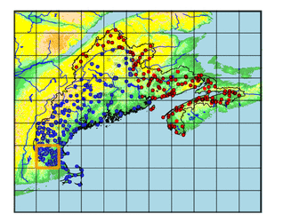
| Name: | LOWELL | Lattitude: | 42.65 |
|---|---|---|---|
| Station ID: | 194313 | Longitude: | -71.32 |
| Data Type: | Snowfall (mm) | Elevation: | 33.5 (m) |
| Data Source: | NCDC | Beginning Year: | 1948 |
| State / Province: | MA | Ending Year: | Present |
| Other Close Sites | ||
|---|---|---|
| Data Type | PointID | Name |
| Air Temperature (C) | 194313 | LOWELL |
| Stream Discharge (cms) | 01099500 | Concord R Below R Meadow Brook, At Lowell, Ma |
| Stream Discharge (cms) | 01100000 | Merrimack River Bl Concord River At Lowell, Ma |
| Precipitation (mm) | 194313 | LOWELL |
| Download | |
|---|---|
| Site Descriptor Information | Site Time Series Data |
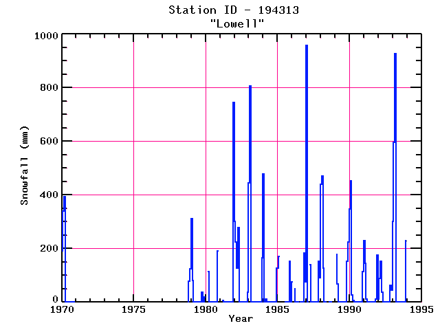
| Point Id | Year | Snowfall mm | |||||||||||
|---|---|---|---|---|---|---|---|---|---|---|---|---|---|
| Jan | Feb | Mar | Apr | May | Jun | Jul | Aug | Sep | Oct | Nov | Dec | ||
| 194313 | 1970 | 190 | 340 | 394 | |||||||||
| 194313 | 1971 | ||||||||||||
| 194313 | 1972 | ||||||||||||
| 194313 | 1973 | ||||||||||||
| 194313 | 1974 | ||||||||||||
| 194313 | 1975 | ||||||||||||
| 194313 | 1976 | ||||||||||||
| 194313 | 1977 | ||||||||||||
| 194313 | 1978 | 79 | 124 | ||||||||||
| 194313 | 1979 | 312 | 81 | 38 | 20 | ||||||||
| 194313 | 1980 | 114 | 190 | ||||||||||
| 194313 | 1981 | 8 | 744 | ||||||||||
| 194313 | 1982 | 302 | 224 | 127 | 279 | 38 | |||||||
| 194313 | 1983 | 444 | 805 | 165 | |||||||||
| 194313 | 1984 | 478 | 13 | 127 | |||||||||
| 194313 | 1985 | 127 | 170 | 152 | |||||||||
| 194313 | 1986 | 76 | 51 | 183 | 76 | ||||||||
| 194313 | 1987 | 958 | 140 | 152 | 91 | ||||||||
| 194313 | 1988 | 439 | 470 | 127 | |||||||||
| 194313 | 1989 | 178 | 69 | 152 | 224 | ||||||||
| 194313 | 1990 | 348 | 452 | 28 | 8 | 114 | |||||||
| 194313 | 1991 | 229 | 145 | 13 | 13 | 175 | |||||||
| 194313 | 1992 | 13 | 89 | 152 | 38 | 64 | 46 | ||||||
| 194313 | 1993 | 302 | 597 | 927 | 229 | ||||||||


