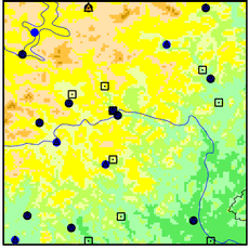
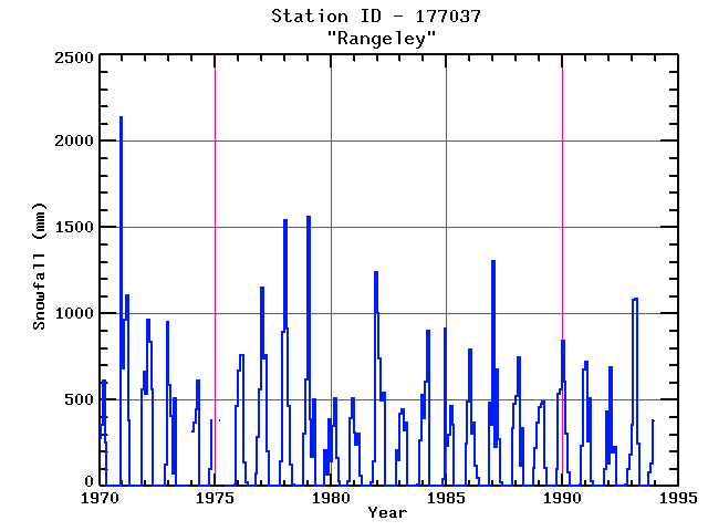
RANGELEY
| Name: | RANGELEY |
Lattitude: | 44.97 |
|---|
| Station ID: | 177037 |
Longitude: | -70.65 |
|---|
| Data Type: | Snowfall (mm) |
Elevation: | 466.3 (m) |
|---|
| Data Source: | NCDC |
Beginning Year: | 1969 |
|---|
| State / Province: | ME |
Ending Year: | Present |
|---|
| Other Close Sites |
|---|
| Data Type | PointID |
Name |
|---|
| Air Temperature (C) |
177037 |
RANGELEY |
| Precipitation (mm) |
177037 |
RANGELEY |
Station Data File:
| Point Id | Year | Snowfall mm |
|---|
| Jan |
Feb |
Mar |
Apr |
May |
Jun |
Jul |
Aug |
Sep |
Oct |
Nov |
Dec |
| 177037 |
1970 | 279 |
356 |
610 |
254 |
|
|
|
|
|
|
|
2139 |
| 177037 |
1971 | 686 |
965 |
1105 |
381 |
|
|
|
|
|
|
559 |
660 |
| 177037 |
1972 | 533 |
965 |
838 |
559 |
|
|
|
|
|
|
127 |
952 |
| 177037 |
1973 | 584 |
406 |
76 |
508 |
|
|
|
|
|
|
|
|
| 177037 |
1974 | 318 |
368 |
444 |
610 |
|
|
|
|
|
102 |
381 |
|
| 177037 |
1975 |
|
|
381 |
|
|
|
|
|
|
|
8 |
467 |
| 177037 |
1976 | 671 |
762 |
757 |
140 |
25 |
|
|
|
|
76 |
287 |
561 |
| 177037 |
1977 | 1148 |
739 |
762 |
203 |
|
|
|
|
|
|
147 |
892 |
| 177037 |
1978 | 1539 |
914 |
462 |
127 |
10 |
|
|
|
|
|
302 |
617 |
| 177037 |
1979 | 1560 |
389 |
173 |
506 |
|
|
|
|
|
206 |
66 |
386 |
| 177037 |
1980 | 147 |
350 |
510 |
165 |
30 |
|
|
|
|
28 |
391 |
508 |
| 177037 |
1981 | 312 |
241 |
307 |
61 |
|
|
|
|
|
20 |
147 |
1240 |
| 177037 |
1982 | 1001 |
742 |
498 |
541 |
|
|
|
|
|
|
206 |
150 |
| 177037 |
1983 | 419 |
447 |
325 |
368 |
|
|
|
|
|
13 |
267 |
528 |
| 177037 |
1984 | 396 |
604 |
899 |
|
|
|
|
|
|
5 |
41 |
914 |
| 177037 |
1985 | 231 |
297 |
465 |
358 |
|
|
|
|
|
|
244 |
493 |
| 177037 |
1986 | 790 |
305 |
366 |
117 |
51 |
|
|
|
|
|
483 |
358 |
| 177037 |
1987 | 1303 |
226 |
678 |
274 |
25 |
|
|
|
|
|
338 |
480 |
| 177037 |
1988 | 521 |
744 |
117 |
335 |
|
|
|
|
|
107 |
221 |
368 |
| 177037 |
1989 | 457 |
475 |
493 |
104 |
|
|
|
|
|
102 |
533 |
564 |
| 177037 |
1990 | 841 |
604 |
305 |
79 |
|
|
|
|
|
13 |
236 |
678 |
| 177037 |
1991 | 724 |
256 |
510 |
30 |
|
|
|
|
|
|
96 |
432 |
| 177037 |
1992 | 132 |
688 |
198 |
226 |
|
|
|
|
|
10 |
102 |
183 |
| 177037 |
1993 | 358 |
1077 |
1087 |
249 |
|
|
|
|
|
81 |
130 |
384 |