 |
 |
|
|
|
|
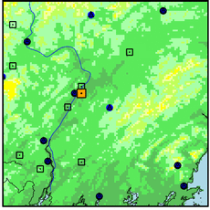
| Name: | Kennebec River Near Waterville,Me | Lattitude: | 44.549999 |
|---|---|---|---|
| Station ID: | 01049205 | Longitude: | -69.616661 |
| Data Type: | Stream Discharge (cms) | Elevation: | |
| Data Source: | USGS | Beginning Year: | |
| State / Province: | ME | Ending Year: |
| Other Close Sites | ||
|---|---|---|
| Data Type | PointID | Name |
| Air Temperature (C) | 179151 | WATERVILLE TRTMNT PL |
| Stream Discharge (cms) | 01048500 | Kennebec River At Waterville, Me |
| Precipitation (mm) | 179151 | WATERVILLE TRTMNT PL |
| Snowfall (mm) | 179151 | WATERVILLE TRTMNT PL |
| Download | |
|---|---|
| Site Descriptor Information | Site Time Series Data |

| Point Id | Year | Discharge m3/s | |||||||||||
|---|---|---|---|---|---|---|---|---|---|---|---|---|---|
| Jan | Feb | Mar | Apr | May | Jun | Jul | Aug | Sep | Oct | Nov | Dec | ||
| 01049205 | 1993 | 103.69 | 151.63 | 269.82 | |||||||||
| 01049205 | 1994 | 180.52 | 195.79 | 214.93 | 784.94 | 504.50 | 200.72 | 160.47 | 107.45 | 103.95 | 106.36 | 145.43 | 163.24 |
| 01049205 | 1995 | 283.10 | 197.24 | 323.05 | 252.56 | 278.68 | 188.62 | 110.13 | 79.23 | 80.21 | 221.36 | 568.78 | 204.05 |
| 01049205 | 1996 | 502.85 | 534.60 | 490.70 | 647.09 | 614.84 | 330.17 | 584.78 | 200.49 | 227.61 | 184.80 | 159.94 | 388.93 |
| 01049205 | 1997 | 194.05 | 206.10 | 214.92 | 624.48 | 491.73 | 195.24 | 153.86 | 88.76 | 119.84 | 107.97 | 189.87 | 96.33 |
| 01049205 | 1998 | 129.07 | 236.29 | 597.05 | 782.87 | 330.82 | 563.10 | 385.68 | 132.97 | 111.93 | |||


