 |
 |
|
|
|
|
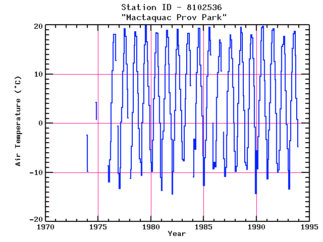
| Name: | MACTAQUAC PROV PARK | Lattitude: | 45.95 |
|---|---|---|---|
| Station ID: | 8102536 | Longitude: | -66.90 |
| Data Type: | Air Temperature (C) | Elevation: | 100 (m) |
| Data Source: | Environment Canada | Beginning Year: | 1973 |
| State / Province: | NB | Ending Year: | Present |
| Other Close Sites | ||
|---|---|---|
| Data Type | PointID | Name |
| Air Temperature (C) | 8102312 | KESWICK RIDGE MACTAQUAC |
| Stream Discharge (cms) | 01AK004 | SAINT JOHN RIVER BELOW MACTAQUAC |
| Precipitation (mm) | 8102312 | KESWICK RIDGE MACTAQUAC |
| Precipitation (mm) | 8102536 | MACTAQUAC PROV PARK |
Due to data provider restrictions, we are not able to provide tabular data for this site at this time.
Download
Site Descriptor Information
Site Time Series Data