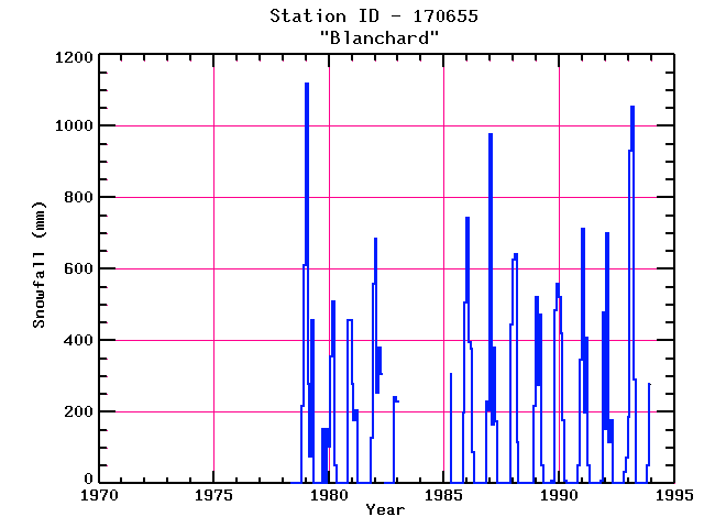
BLANCHARD
| Name: | BLANCHARD |
Lattitude: | 45.27 |
|---|
| Station ID: | 170655 |
Longitude: | -69.6 |
|---|
| Data Type: | Snowfall (mm) |
Elevation: | 182.9 (m) |
|---|
| Data Source: | NCDC |
Beginning Year: | 1968 |
|---|
| State / Province: | ME |
Ending Year: | Present |
|---|
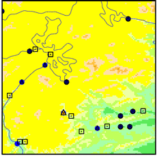
| Other Close Sites |
|---|
| Data Type | PointID |
Name |
|---|
| Precipitation (mm) |
170655 |
BLANCHARD |
Station Data File:
| Point Id | Year | Snowfall mm |
|---|
| Jan |
Feb |
Mar |
Apr |
May |
Jun |
Jul |
Aug |
Sep |
Oct |
Nov |
Dec |
| 170655 |
1970 |
|
|
|
|
|
|
|
|
|
|
|
|
| 170655 |
1971 |
|
|
|
|
|
|
|
|
|
|
|
|
| 170655 |
1972 |
|
|
|
|
|
|
|
|
|
|
|
|
| 170655 |
1973 |
|
|
|
|
|
|
|
|
|
|
|
|
| 170655 |
1974 |
|
|
|
|
|
|
|
|
|
|
|
|
| 170655 |
1975 |
|
|
|
|
|
|
|
|
|
|
|
|
| 170655 |
1976 |
|
|
|
|
|
|
|
|
|
|
|
|
| 170655 |
1977 |
|
|
|
|
|
|
|
|
|
|
|
|
| 170655 |
1978 |
|
|
|
|
|
|
|
|
|
|
216 |
610 |
| 170655 |
1979 | 1118 |
279 |
76 |
457 |
|
|
|
|
|
152 |
|
152 |
| 170655 |
1980 | 102 |
356 |
508 |
51 |
|
|
|
|
|
|
457 |
457 |
| 170655 |
1981 | 279 |
178 |
203 |
|
|
|
|
|
|
|
127 |
559 |
| 170655 |
1982 | 686 |
254 |
381 |
305 |
|
|
|
|
|
|
241 |
229 |
| 170655 |
1983 | 229 |
|
|
|
|
|
|
|
|
|
|
|
| 170655 |
1984 |
|
|
|
|
|
|
|
|
|
|
|
|
| 170655 |
1985 |
|
|
|
305 |
|
|
|
|
|
|
198 |
506 |
| 170655 |
1986 | 744 |
396 |
376 |
89 |
|
|
|
|
|
|
229 |
206 |
| 170655 |
1987 | 978 |
165 |
381 |
173 |
|
|
|
|
|
|
|
444 |
| 170655 |
1988 | 625 |
643 |
114 |
|
|
|
|
|
|
|
|
216 |
| 170655 |
1989 | 521 |
277 |
472 |
51 |
|
|
|
|
8 |
|
485 |
559 |
| 170655 |
1990 | 521 |
419 |
178 |
8 |
|
|
|
|
|
|
51 |
345 |
| 170655 |
1991 | 711 |
198 |
406 |
51 |
|
|
|
|
|
|
8 |
478 |
| 170655 |
1992 | 152 |
698 |
114 |
178 |
|
|
|
|
|
|
33 |
71 |
| 170655 |
1993 | 185 |
930 |
1054 |
292 |
|
|
|
|
|
|
51 |
279 |