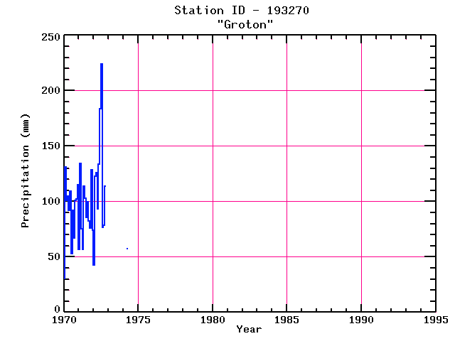
GROTON
| Name: | GROTON |
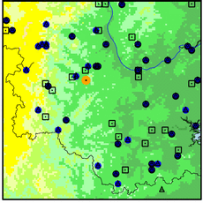
Lattitude: | 42.6 |
|---|
| Station ID: | 193270 |
Longitude: | -71.58 |
|---|
| Data Type: | Precipitation (mm) |
Elevation: | 103.9 (m) |
|---|
| Data Source: | NCDC |
Beginning Year: | 1948 |
|---|
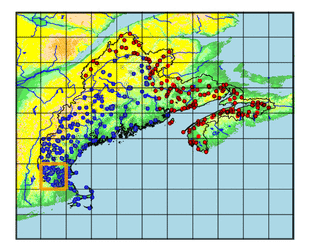
| State / Province: | MA |
Ending Year: | 1974 |
|---|
| Other Close Sites |
|---|
| Data Type | PointID |
Name |
|---|
| Snowfall (mm) |
193270 |
GROTON |
Station Data File:
| Point Id | Year | PPT mm |
|---|
| Jan |
Feb |
Mar |
Apr |
May |
Jun |
Jul |
Aug |
Sep |
Oct |
Nov |
Dec |
| 193270 |
1970 | 30 |
131 |
101 |
105 |
92 |
109 |
53 |
92 |
67 |
101 |
102 |
115 |
| 193270 |
1971 | 57 |
134 |
75 |
57 |
114 |
103 |
86 |
100 |
82 |
76 |
129 |
74 |
| 193270 |
1972 | 43 |
123 |
126 |
93 |
134 |
184 |
224 |
76 |
79 |
114 |
|
|
| 193270 |
1973 |
|
|
|
|
|
|
|
|
|
|
|
|
| 193270 |
1974 |
|
|
|
57 |
|
|
|
|
|
|
|
|
| 193270 |
1975 |
|
|
|
|
|
|
|
|
|
|
|
|
| 193270 |
1976 |
|
|
|
|
|
|
|
|
|
|
|
|
| 193270 |
1977 |
|
|
|
|
|
|
|
|
|
|
|
|
| 193270 |
1978 |
|
|
|
|
|
|
|
|
|
|
|
|
| 193270 |
1979 |
|
|
|
|
|
|
|
|
|
|
|
|
| 193270 |
1980 |
|
|
|
|
|
|
|
|
|
|
|
|
| 193270 |
1981 |
|
|
|
|
|
|
|
|
|
|
|
|
| 193270 |
1982 |
|
|
|
|
|
|
|
|
|
|
|
|
| 193270 |
1983 |
|
|
|
|
|
|
|
|
|
|
|
|
| 193270 |
1984 |
|
|
|
|
|
|
|
|
|
|
|
|
| 193270 |
1985 |
|
|
|
|
|
|
|
|
|
|
|
|
| 193270 |
1986 |
|
|
|
|
|
|
|
|
|
|
|
|
| 193270 |
1987 |
|
|
|
|
|
|
|
|
|
|
|
|
| 193270 |
1988 |
|
|
|
|
|
|
|
|
|
|
|
|
| 193270 |
1989 |
|
|
|
|
|
|
|
|
|
|
|
|
| 193270 |
1990 |
|
|
|
|
|
|
|
|
|
|
|
|
| 193270 |
1991 |
|
|
|
|
|
|
|
|
|
|
|
|
| 193270 |
1992 |
|
|
|
|
|
|
|
|
|
|
|
|
| 193270 |
1993 |
|
|
|
|
|
|
|
|
|
|
|
|