TELOS DAM
| Name: | TELOS DAM |
Lattitude: | 46.15 |
|---|
| Station ID: | 178688 |
Longitude: | -69.13 |
|---|
| Data Type: | Precipitation (mm) |
Elevation: | 292.6 (m) |
|---|
| Data Source: | NCDC |
Beginning Year: | 1962 |
|---|
| State / Province: | ME |
Ending Year: | 1986 |
|---|
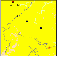
| Other Close Sites |
|---|
| Data Type | PointID |
Name |
|---|
| Air Temperature (C) |
178688 |
TELOS DAM |
| Snowfall (mm) |
178688 |
TELOS DAM |
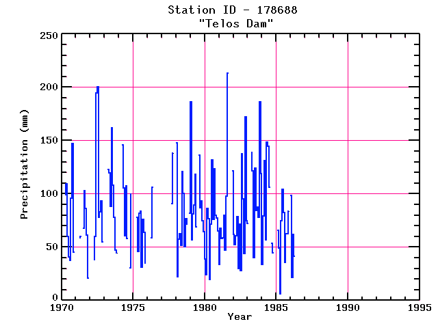
Station Data File:
| Point Id | Year | PPT mm |
|---|
| Jan |
Feb |
Mar |
Apr |
May |
Jun |
Jul |
Aug |
Sep |
Oct |
Nov |
Dec |
| 178688 |
1970 |
|
|
|
99 |
110 |
60 |
40 |
38 |
96 |
147 |
46 |
|
| 178688 |
1971 |
|
|
|
59 |
60 |
|
68 |
103 |
86 |
61 |
21 |
|
| 178688 |
1972 |
|
|
|
38 |
60 |
194 |
200 |
78 |
83 |
94 |
55 |
|
| 178688 |
1973 |
|
|
|
123 |
120 |
88 |
162 |
108 |
78 |
47 |
45 |
|
| 178688 |
1974 |
|
|
|
146 |
106 |
61 |
107 |
58 |
|
30 |
100 |
|
| 178688 |
1975 |
|
|
|
78 |
46 |
82 |
84 |
31 |
76 |
64 |
35 |
|
| 178688 |
1976 |
|
|
|
58 |
106 |
|
|
|
|
|
|
|
| 178688 |
1977 |
|
|
|
|
|
|
|
|
91 |
138 |
|
|
| 178688 |
1978 | 148 |
22 |
57 |
63 |
52 |
121 |
100 |
50 |
77 |
72 |
|
82 |
| 178688 |
1979 | 186 |
57 |
81 |
89 |
118 |
69 |
|
136 |
87 |
93 |
74 |
64 |
| 178688 |
1980 | 39 |
24 |
86 |
76 |
20 |
71 |
132 |
76 |
123 |
80 |
77 |
65 |
| 178688 |
1981 | 34 |
68 |
58 |
58 |
80 |
47 |
98 |
213 |
|
|
|
121 |
| 178688 |
1982 | 62 |
52 |
60 |
78 |
30 |
71 |
28 |
138 |
95 |
44 |
172 |
74 |
| 178688 |
1983 | 72 |
|
|
139 |
121 |
40 |
124 |
85 |
88 |
78 |
186 |
119 |
| 178688 |
1984 | 34 |
79 |
131 |
57 |
148 |
144 |
106 |
|
53 |
45 |
|
|
| 178688 |
1985 |
|
66 |
49 |
6 |
75 |
104 |
82 |
36 |
63 |
62 |
84 |
|
| 178688 |
1986 | 98 |
22 |
62 |
41 |
|
|
|
|
|
|
|
|
| 178688 |
1987 |
|
|
|
|
|
|
|
|
|
|
|
|
| 178688 |
1988 |
|
|
|
|
|
|
|
|
|
|
|
|
| 178688 |
1989 |
|
|
|
|
|
|
|
|
|
|
|
|
| 178688 |
1990 |
|
|
|
|
|
|
|
|
|
|
|
|
| 178688 |
1991 |
|
|
|
|
|
|
|
|
|
|
|
|
| 178688 |
1992 |
|
|
|
|
|
|
|
|
|
|
|
|
| 178688 |
1993 |
|
|
|
|
|
|
|
|
|
|
|
|