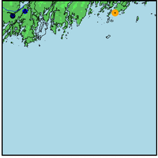
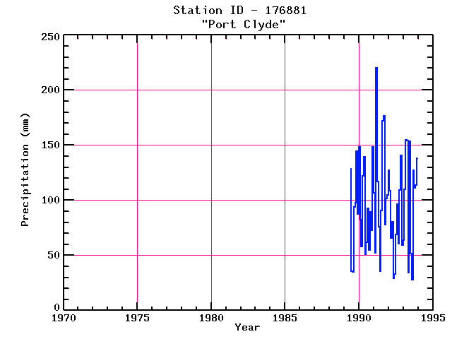
PORT CLYDE
| Name: | PORT CLYDE |
Lattitude: | 43.92 |
|---|
| Station ID: | 176881 |
Longitude: | -69.27 |
|---|
| Data Type: | Precipitation (mm) |
Elevation: | 9.1 (m) |
|---|
| Data Source: | NCDC |
Beginning Year: | 1989 |
|---|
| State / Province: | ME |
Ending Year: | Present |
|---|
| Other Close Sites |
|---|
| Data Type | PointID |
Name |
|---|
| Air Temperature (C) |
176881 |
PORT CLYDE |
| Snowfall (mm) |
176881 |
PORT CLYDE |
Station Data File:
| Point Id | Year | PPT mm |
|---|
| Jan |
Feb |
Mar |
Apr |
May |
Jun |
Jul |
Aug |
Sep |
Oct |
Nov |
Dec |
| 176881 |
1970 |
|
|
|
|
|
|
|
|
|
|
|
|
| 176881 |
1971 |
|
|
|
|
|
|
|
|
|
|
|
|
| 176881 |
1972 |
|
|
|
|
|
|
|
|
|
|
|
|
| 176881 |
1973 |
|
|
|
|
|
|
|
|
|
|
|
|
| 176881 |
1974 |
|
|
|
|
|
|
|
|
|
|
|
|
| 176881 |
1975 |
|
|
|
|
|
|
|
|
|
|
|
|
| 176881 |
1976 |
|
|
|
|
|
|
|
|
|
|
|
|
| 176881 |
1977 |
|
|
|
|
|
|
|
|
|
|
|
|
| 176881 |
1978 |
|
|
|
|
|
|
|
|
|
|
|
|
| 176881 |
1979 |
|
|
|
|
|
|
|
|
|
|
|
|
| 176881 |
1980 |
|
|
|
|
|
|
|
|
|
|
|
|
| 176881 |
1981 |
|
|
|
|
|
|
|
|
|
|
|
|
| 176881 |
1982 |
|
|
|
|
|
|
|
|
|
|
|
|
| 176881 |
1983 |
|
|
|
|
|
|
|
|
|
|
|
|
| 176881 |
1984 |
|
|
|
|
|
|
|
|
|
|
|
|
| 176881 |
1985 |
|
|
|
|
|
|
|
|
|
|
|
|
| 176881 |
1986 |
|
|
|
|
|
|
|
|
|
|
|
|
| 176881 |
1987 |
|
|
|
|
|
|
|
|
|
|
|
|
| 176881 |
1988 |
|
|
|
|
|
|
|
|
|
|
|
|
| 176881 |
1989 |
|
|
|
|
|
128 |
36 |
35 |
94 |
98 |
144 |
87 |
| 176881 |
1990 | 148 |
82 |
58 |
122 |
139 |
51 |
62 |
93 |
55 |
90 |
73 |
148 |
| 176881 |
1991 | 107 |
52 |
220 |
117 |
76 |
36 |
91 |
172 |
177 |
78 |
102 |
105 |
| 176881 |
1992 | 127 |
108 |
66 |
80 |
29 |
33 |
69 |
96 |
60 |
109 |
140 |
59 |
| 176881 |
1993 | 64 |
110 |
155 |
154 |
34 |
154 |
52 |
28 |
127 |
111 |
114 |
138 |