HAYNESVILLE
| Name: | HAYNESVILLE |
Lattitude: | 45.85 |
|---|
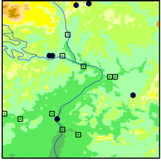
| Station ID: | 173651 |
Longitude: | -68 |
|---|
| Data Type: | Precipitation (mm) |
Elevation: | 118.9 (m) |
|---|
| Data Source: | NCDC |
Beginning Year: | 1973 |
|---|
| State / Province: | ME |
Ending Year: | 1977 |
|---|

Station Data File:
| Point Id | Year | PPT mm |
|---|
| Jan |
Feb |
Mar |
Apr |
May |
Jun |
Jul |
Aug |
Sep |
Oct |
Nov |
Dec |
| 173651 |
1970 |
|
|
|
|
|
|
|
|
|
|
|
|
| 173651 |
1971 |
|
|
|
|
|
|
|
|
|
|
|
|
| 173651 |
1972 |
|
|
|
|
|
|
|
|
|
|
|
|
| 173651 |
1973 |
|
|
|
|
|
|
|
|
87 |
41 |
87 |
183 |
| 173651 |
1974 | 59 |
34 |
73 |
146 |
114 |
98 |
69 |
60 |
100 |
36 |
89 |
59 |
| 173651 |
1975 | 67 |
46 |
70 |
41 |
43 |
134 |
98 |
25 |
115 |
80 |
130 |
112 |
| 173651 |
1976 | 108 |
118 |
76 |
123 |
140 |
72 |
156 |
149 |
66 |
134 |
65 |
122 |
| 173651 |
1977 | 63 |
80 |
65 |
49 |
25 |
238 |
34 |
125 |
122 |
|
|
|
| 173651 |
1978 |
|
|
|
|
|
|
|
|
|
|
|
|
| 173651 |
1979 |
|
|
|
|
|
|
|
|
|
|
|
|
| 173651 |
1980 |
|
|
|
|
|
|
|
|
|
|
|
|
| 173651 |
1981 |
|
|
|
|
|
|
|
|
|
|
|
|
| 173651 |
1982 |
|
|
|
|
|
|
|
|
|
|
|
|
| 173651 |
1983 |
|
|
|
|
|
|
|
|
|
|
|
|
| 173651 |
1984 |
|
|
|
|
|
|
|
|
|
|
|
|
| 173651 |
1985 |
|
|
|
|
|
|
|
|
|
|
|
|
| 173651 |
1986 |
|
|
|
|
|
|
|
|
|
|
|
|
| 173651 |
1987 |
|
|
|
|
|
|
|
|
|
|
|
|
| 173651 |
1988 |
|
|
|
|
|
|
|
|
|
|
|
|
| 173651 |
1989 |
|
|
|
|
|
|
|
|
|
|
|
|
| 173651 |
1990 |
|
|
|
|
|
|
|
|
|
|
|
|
| 173651 |
1991 |
|
|
|
|
|
|
|
|
|
|
|
|
| 173651 |
1992 |
|
|
|
|
|
|
|
|
|
|
|
|
| 173651 |
1993 |
|
|
|
|
|
|
|
|
|
|
|
|