 |
 |
|
|
|
|
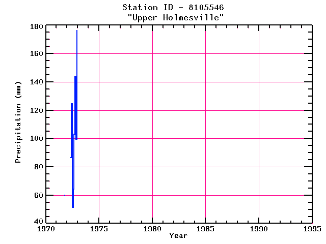
| Name: | UPPER HOLMESVILLE | Lattitude: | 46.62 |
|---|---|---|---|
| Station ID: | 8105546 | Longitude: | -67.62 |
| Data Type: | Precipitation (mm) | Elevation: | 183 (m) |
| Data Source: | Environment Canada | Beginning Year: | 1971 |
| State / Province: | NB | Ending Year: | 1972 |
Due to data provider restrictions, we are not able to provide tabular data for this site at this time.
Download
Site Descriptor Information
Site Time Series Data