 |
 |
|
|
|
|
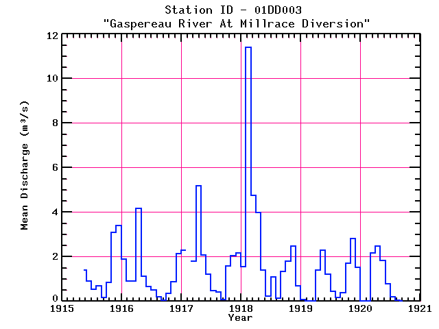
| Name: | GASPEREAU RIVER AT MILLRACE DIVERSION | Lattitude: | 45.049999 |
|---|---|---|---|
| Station ID: | 01DD003 | Longitude: | -64.416664 |
| Data Type: | Stream Discharge (cms) | Elevation: | |
| Data Source: | HYDAT | Beginning Year: | |
| State / Province: | NS | Ending Year: |
| Other Close Sites | ||
|---|---|---|
| Data Type | PointID | Name |
| Stream Discharge (cms) | 01DD001 | GASPEREAU RIVER AT MARTIN'S BRIDGE |
| Precipitation (mm) | 8206316 | WHITE ROCK |
Due to data provider restrictions, we are not able to provide tabular data for this site at this time.
Download
Site Descriptor Information
Site Time Series Data