 |
 |
|
|
|
|
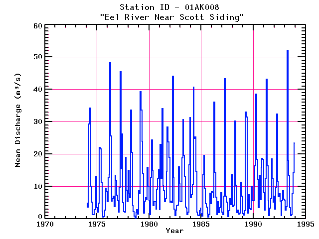
| Name: | EEL RIVER NEAR SCOTT SIDING | Lattitude: | 45.950001 |
|---|---|---|---|
| Station ID: | 01AK008 | Longitude: | -67.549995 |
| Data Type: | Stream Discharge (cms) | Elevation: | |
| Data Source: | HYDAT | Beginning Year: | |
| State / Province: | NB | Ending Year: |
Due to data provider restrictions, we are not able to provide tabular data for this site at this time.
Download
Site Descriptor Information
Site Time Series Data